Mission Room
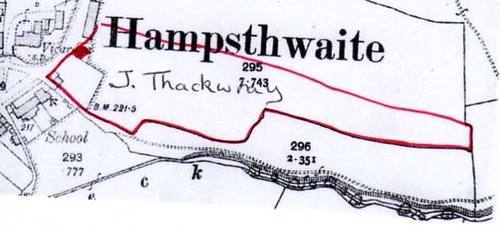
In this portion of a plan showing the junction of Church Lane with the village green we see, on the north side of the school, the site on which now stands Saddler's Cottage (
click here to see the entry for the cottage). The red outline indicates the approximate extent of the plot belonging in the 1770s to J.Thackwray - according to the plan then drawn as an accompaniment to the Inclosure Awards for the Forest of Knaresborough. The small area blocked in red indicates the position of some building which then existed.
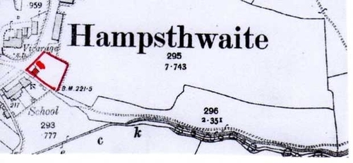
By the time of the publication of the first Ordnance Survey Map in 1853 a number of buildings seem to have been added to the site as shown on this second plan.

The single building shown in the 1770's now seems to form part of a line or terrace of buildings behind which there seems to be a more substantial property occupying the back portion of the plot. We do not know what these buildings were but William Grainge in his history "Harrogate and the Forest of Knaresborough" published in 1871 described them thus . . . . .
"three distinct tenements, two storeys in height in front, but only about eight feet in height at the back. The northern gable, with a large projecting chimney, is a piece of excellent masonry, and is probably older than the side walls. The roof is covered with thatch". He makes no mention of a building behind.
By 1891 the Ordnance Survey revealed only two buildings on the site as shown here
One of the buildings is clearly Saddler's Cottage but the other stands separately to the north and it is not clear whether it is another survivor of the terrace or a new construction. The Ordnance Survey calls it "Mission Room". It does not have a long history for by 1909 it disappears from the Survey and has, it is presumed, been demolished .
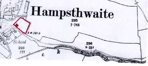
It may be that future research will reveal the story of the "Mission Room" of which, at present, nothing is known.
Return to main map